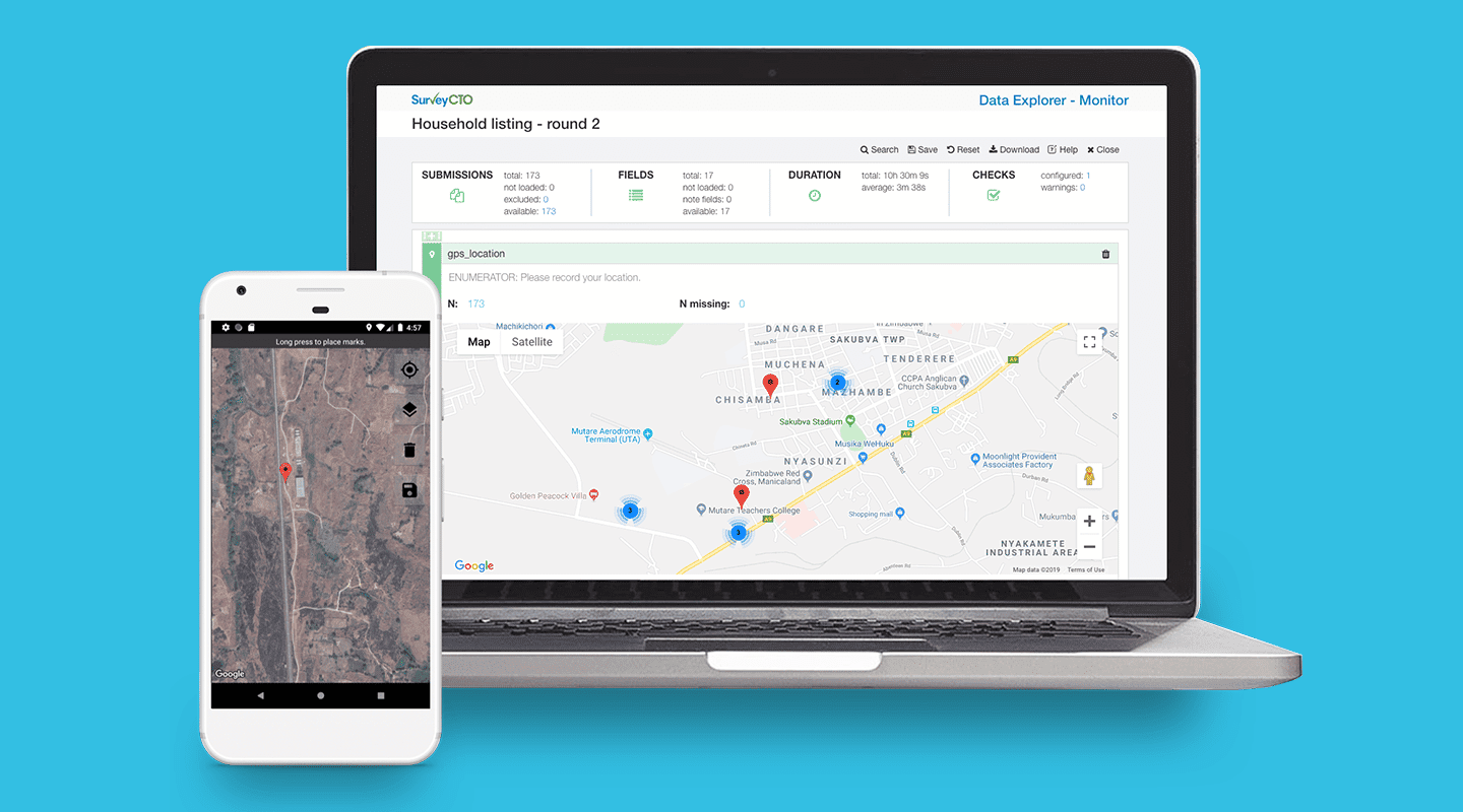
You can use your device’s built-in GPS to collect GPS data in SurveyCTO, whether you’re online or offline. Explore our advanced capabilities for geolocation data collection in the field.
What is geolocation data?
Geolocation data is information that pinpoints an electronic device’s location. The built-in GPS (Global Positioning System) in devices like mobile phones, smart watches, and tablets, generates a set of latitudinal and longitudinal geographic coordinates to determine a device’s location. This does not mean that we can track the location of devices, but rather that you can gather precise location data in your forms while out in the field.
Geolocation data examples in surveys
Geolocation data is widely used by researchers and non-profit organizations for survey work. Some examples of when this data is useful are when carrying out surveys to map distances between households, calculating plot sizes (for example, in agricultural surveys), and verifying that enumerators are following up with the correct household.
How to collect geolocation data with SurveyCTO
When field researchers are collecting geolocation data in a new location or rebooting their devices, as often is the case, it might take a while for them to connect to GPS satellites and capture accurate locations.
On top of this, if they’re collecting data in remote areas, for example when mapping fields to calculate plot sizes, they might find themselves with a weak mobile network signal or, worse, no connectivity at all.
Survey tools like SurveyCTO can solve these problems to make it faster and easier to collect geolocation data.
Collecting geolocation data online
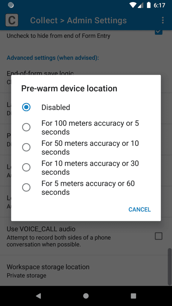
To quickly capture accurate geolocation data, enumerators can configure SurveyCTO Collect to “pre-warm” the device’s GPS unit at the start of any form that needs to access maps to collect location data. This helps the device capture accurate GPS position faster, so that enumerators can get results and make decisions faster.
To pre-warm a device’s GPS, go to the “Collect” main menu, click on the three-dot menu in the upper-right, select “Admin Settings”, scroll down to the bottom, and select one of the pre-warm device location options

Collecting geolocation data offline
Using SurveyCTO’s geopoint field, along with a device’s built-in GPS support, field researchers can collect GPS coordinates even when they are collecting data in an area without internet. This allows them to immediately pinpoint locations on a map.
However, enumerators often need to collect GPS points as they navigate a route or boundary to map an area. This is known as geoshape and geotrace data, and allows researchers to measure the distance between known points on a map. For example, when measuring distances between community resources in household surveys.
Typically, they would need to be connected to the internet to do this.
A way around this: field researchers can download and store (or cache) maps on their devices in an area with internet connectivity, so they access them when they’re next offline. But, this isn’t the most reliable or accurate way to collect GPS data. For that, they’ll need to install MBTiles in SurveyCTO.
How to use MBTiles to collect offline geolocation data with SurveyCTO: a quick 4-step guide
To make sure you reliably collect accurate geolocation data, you’ll need to use MBTiles (a file format for storing map tiles in a single file).
This is especially important when you want to verify that enumerators are surveying the correct respondent (by location), say in a follow-up survey.
Below, we’ve outlined the steps involved to get MBTiles up and running with SurveyCTO.
1. Create MBTiles
First, you’ll need to create MBTiles using the HOT Export Tool. This tool is free and is the easiest way to create MBTiles. For the exact steps on how to create your MBTiles, jump to the Creating MBTiles files with the HOT Export Tool section in this offline maps guide.
Once you have your MBTiles file ready, you can move them to your device.
2. Get MBTiles onto your device
There are many ways in which you can get MBTiles onto your device, depending on your browser and processes. Here, we’ve listed the most popular ways to do this:
- Upload MBTiles to the cloud, and then download them to your device
- Distribute MBTiles files via downloadable links
- On a Windows computer, connect your Android device with a USB cable, and simply drag and drop files to the correct folder
- On a MacOS computer, use Android File Transfer to copy the MBTiles files to the Android device
3. Use repeated fields and indexed-repeat()
a. On your Android device, navigate to the layers folder in SurveyCTO Collect:
/Android/data/com.surveycto.collect.android/files/config/layers/b. Now, create a folder for each MBTiles file. The name of the folder should be the name of the layer to be shared with the enumerator.
c. Move or copy each MBTiles file to its corresponding folder within the layers folder. Make sure there is only one file per folder in the layers folder.
d. Repeat these steps for each MBTiles file you would like to install.
4. Using MBTiles in SurveyCTO
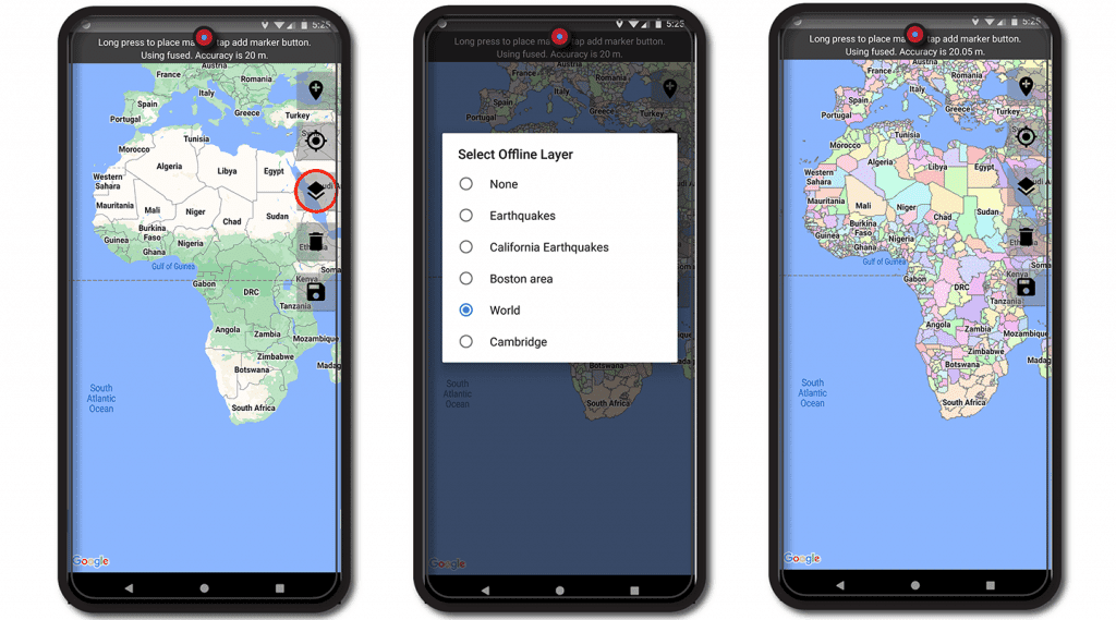
When you need to collect geolocation data in a survey, simply tap on “View” or “Change Location” in SurveyCTO Collect to open a map.
Choose either to zoom to your “current location” or a “saved location.” Next, tap on the layers button (circled in red below), select the layer you would like to use, and the layer will appear:

While this is an advanced method of collecting geolocation data offline, SurveyCTO Collect makes it as straightforward as possible thanks to its compatibility with MBTiles.
If you have any issues, reach out to SurveyCTO support or check out our Collecting GPS data and Offline GPS and maps using MBTiles documentation for further guidance.
Try out SurveyCTO. Start a free 15-day trial today.

